
Mt. Bierstadt trip report
One thing we know about human migration in the Paleolithic: humankind walked a lot. While it took countless generations for our ancestors to the reach France, Spain and Britain from Africa, the bottom line, they walked. Around 13,000 years ago, they walked into Colorado. While it is not known when Native Americans first climbed a Colorado peak, it is believed Mt. Beirstadt was one of them. For paleoterran fitness and rejuvenation, a summer climb was in order.
Mt. Bierstadt, rising to 14,060 feet, is Colorado’s 38th highest peak. Located in the Front Range and within easy access from Denver, the mountain is ideal for an August ascent. For my son, it would be his second Bierstadt climb; for me, my first 14er.
 Departing Denver at 5:07 am on August 15, we drove south on Colorado Blvd and turned west on Hampden Avenue (Highway-285). At Grant, forty miles outside of Denver, we turned right on the Guanella Scenic and Historic Byway, a gravel and paved two-lane road also known as Guanella Pass Road and County Road 62.
Bierstadt Trail
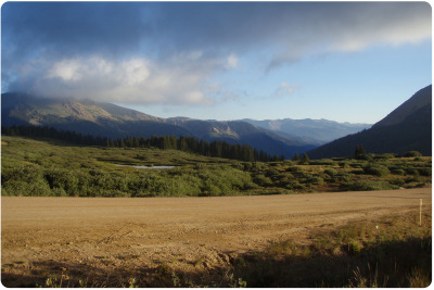
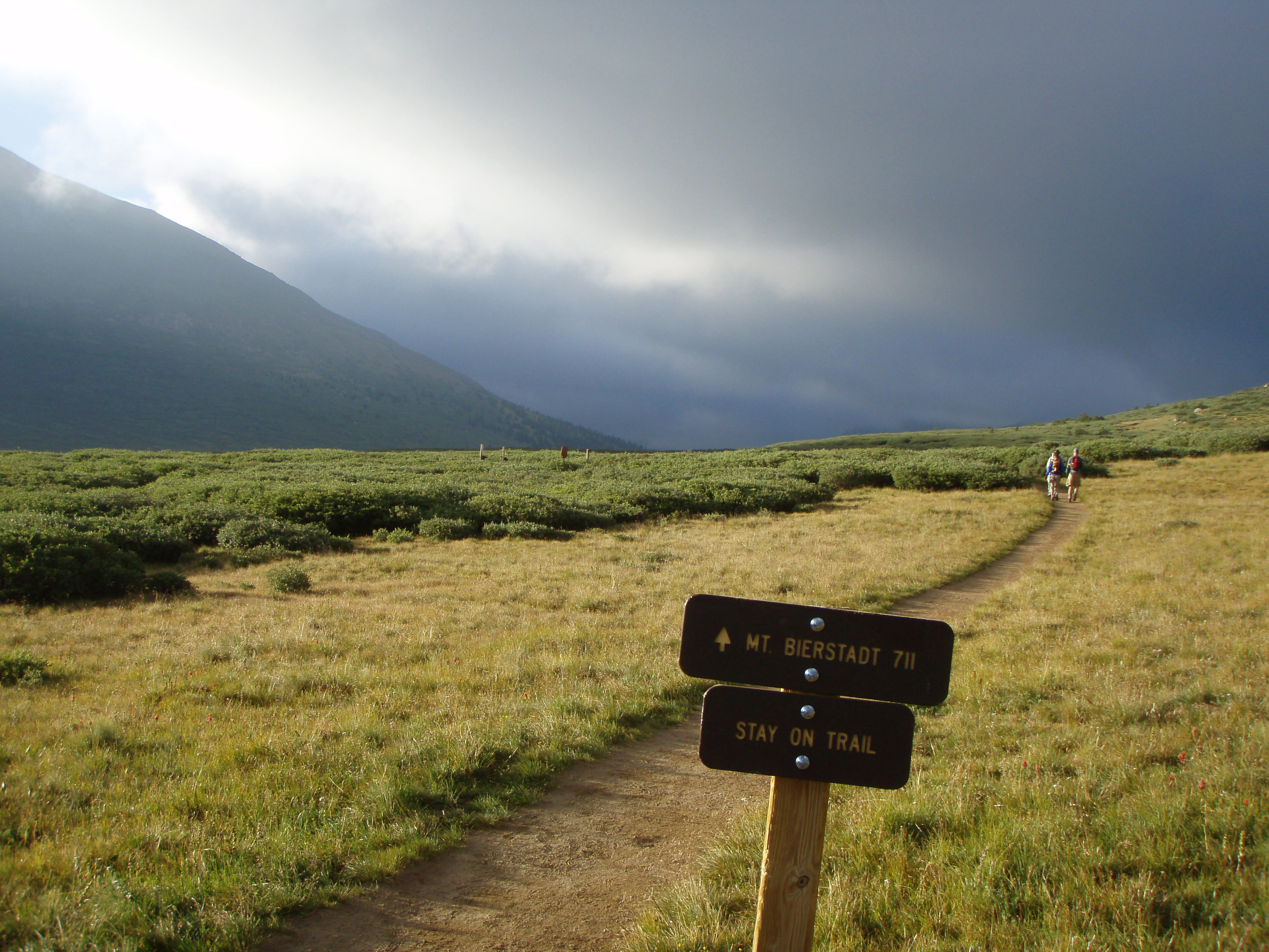
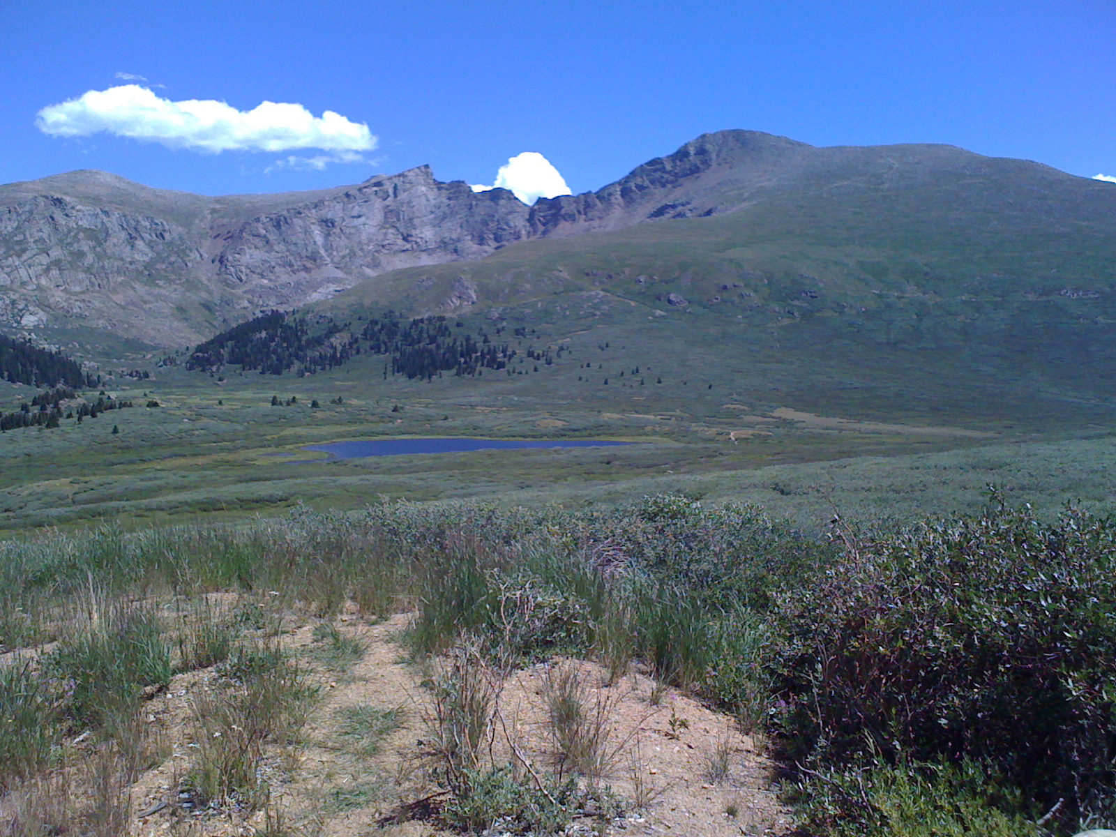
As the morning sun began to light the valley, we reached the apex of Guanella Pass, 12 miles from Grant, and parked in the lot on the right side of the road. Our hike on the Bierstadt Trail began at 7:05 am; the foreboding clouds to the south (image below) dissipated with the rising sun.
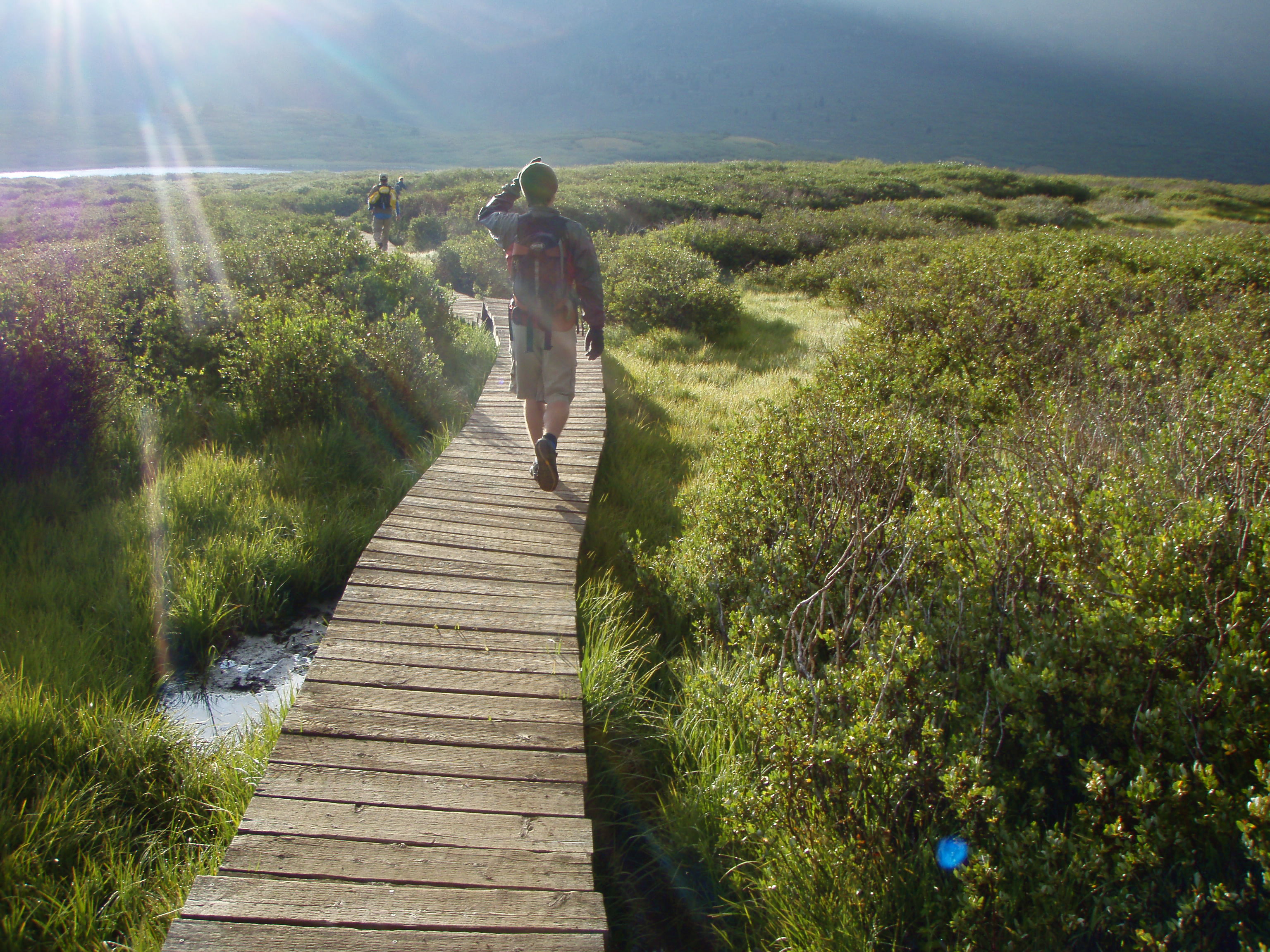
 Even before German-American painter Albert Bierstadt visited the mountain now bearing his name in 1863, hikers have trudged through the “dreaded willows” at the start of the hike. This segment is now comfortably passable using the recently constructed wooden footbridges.
The trail gently descended for 3/4 of a mile to Scott Gomer Creek, its lowest point. The elevation gained varies depending on how it is measured. Some measure the gain from the Guanella Pass Trailhead (11,699 ft.) to the peak for an elevation gain of 2,361 feet. Others, such as Gerry Roach, measure from Gomer Creek (11,290 ft.) to the peak for a gain of 2,770 feet. The distance from trailhead to summit is 3 miles.
Walking through a short segment of small boulders, we crossed Gomer Creek and followed the well-defined trail through more willows. As it began to rise along Bierstadt’s western slope and eventually led to a segment with switchbacks angling through scattered boulders and marked by few large Cairns.
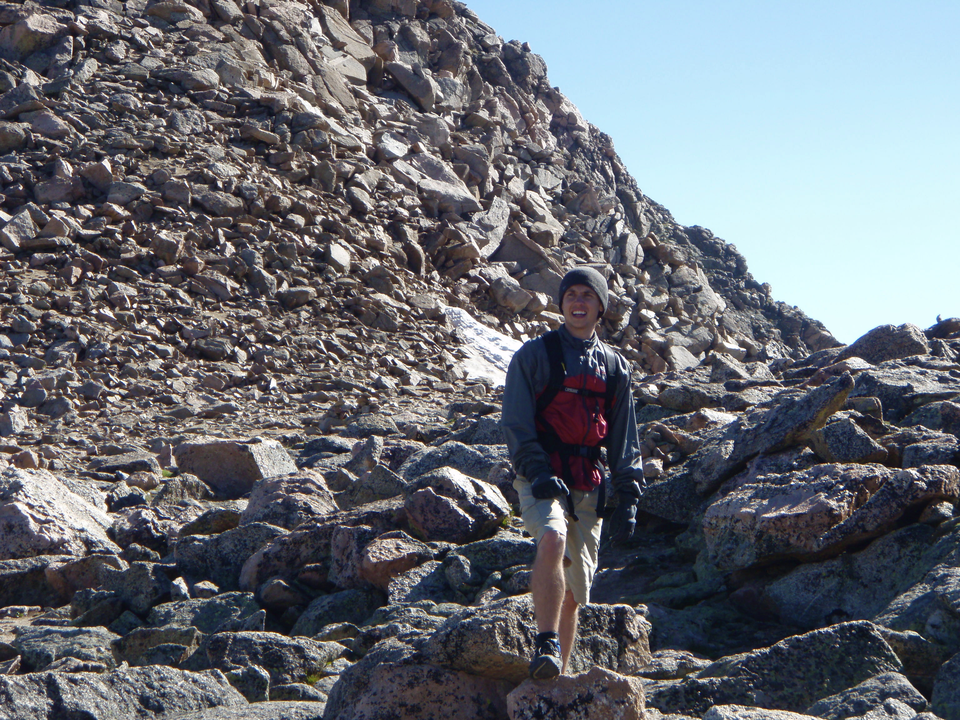 Temperatures were in the 40s to 50s and there was little wind. As the sun rose higher, we shed our outer layers and replaced them at higher elevations. The southern ridge begins at 13,780 feet and leads to the peak a quarter mile away (Roach). After a final short scramble on a steeper segment of boulders, we reached the summit at 10:06 am. Stares and big smiles were the spontaneous response. The spectacular views, beautiful weather and a non-threatening sky kept us on the summit about 30 minutes.
Descent
Descending Bierstadt required closer attention in order to avoid stumbling (this is were walking sticks shine). Longer breaks allowed us to soak in the views, take pictures, and share impressions of the experience. Travel through the willows and gentle ascent to the parking lot felt like cool down following an exercise session. We reached the lot at 1:29 pm, a 6.5-hour hike and an unforgettable day.
 Mt. Bierstadt is a great starter mountain for those keen on climbing 14ers. However, since the Bierstadt Trail is completely above tree line, preparation and alertness are important. As Louis Dawson writes, “don’t let the hike nature of this climb lull you into false security. You need proper clothing, and you need to time your ascent to avoid afternoon electrical storms.”
As with any mountaineering, the weather can quickly change. In the July 2010 issue of Mountain Gazette, Gene Coatney describes his families experience while climbing Pagosa Peak. “Lightening began punching near us, deafening us with its thunder and sending (daughter) into a panic. Then the downpour began.” The family eventually made it safely to their car and, a year or so later, Gene and his daughter climbed the peak again. Although periodically ready to turn back, she overcame her fear and reached the summit.
Heading Home
The hike up Mt. Bierstadt heightens your awareness of the need to preserve the experience for others, a goal championed by the Colorado Fourteeners Initiative. The trail was clean and the natural life appeared mostly undisturbed. With regard to the physical challenge, the heart beat faster with increased effort at the higher elevations and quickly diminished during occasional breaks. Deeper breaths inhaling less dense air were cleansing. I suspect in the inner world, vessels dilated, new capillaries were formed and stem cells were stimulated to preserve brain density (more on this in future entries). Of all the rewards, the greatest was enjoying nature’s splendor accompanied by my oldest son.
 Dr. John
Reader Comments